Bunkers of the Tossal de Sant Joan de Vilamur
Self-guided tour
An area where excavation and improvement work is still ongoing. The historical reenactments held here every year are particularly noteworthy.
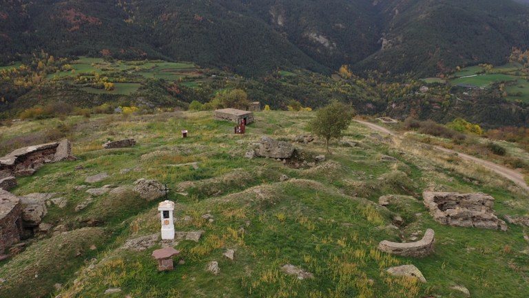
This self-guided tour will help you during your visit and provide the information you need to understand what surrounds you, thanks to the excavations and subsequent studies carried out by the archaeologists and historians who have worked here. You can also explore the bibliography relating to this site afterwards.
Welcome to the fortifications and bunkers of the Tossal de Sant Joan de Vilamur, at an altitude of 1,320 m. Built during the Spanish Civil War by Francoist troops, they form one of the best-preserved defensive complexes in the Pyrenees. Excavation and improvement work is still ongoing, and the historical reenactments held here every year are particularly noteworthy.
Instructions
The instructions are very simple: follow the route shown on the map, where you will find the points marked with their corresponding numbers. This is the most logical itinerary, although you are free to visit the points in any order according to your interests.
Location
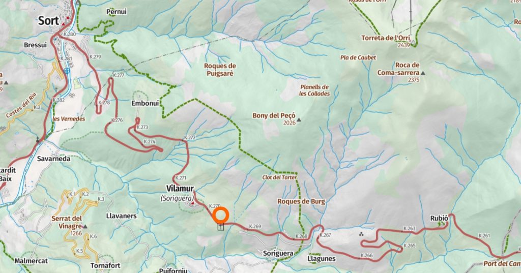
The site is located on the Tossal de Sant Joan de Vilamur (1,320 m), 500 m south-east of the village of Vilamur. It can be reached by an unpaved road or by a footpath from the village itself, in about 20 minutes. We recommend parking in the village, which is also worth a visit, and walking to the site from there.
Basic information about the site
This is a defensive complex from the Spanish Civil War (1936-1939), built by the Francoist army using the elevated position of the rocky formation of the tossal.
The Vilamur resistance centre, together with various positions extending north-east towards Bony del Peço and Les Collades and westwards towards Serrat del Vinagre and Tornafort, controlled any Republican incursion coming from the Port del Cantó pass.
The defensive complex that has survived consisted of 9 casemates and several parapets linked by a network of trenches. The bunkers were built from stone bonded with mortar and from timber formwork structures. They had chimneys to protect soldiers from the winter cold and loopholes facing in all directions for rifle fire, some of which were also suitable for machine guns. The entire position was also surrounded by barbed-wire entanglements.
The Vilamur resistance centre
The Vilamur resistance centre, together with various positions extending north-east towards Bony del Peço and Les Collades and westwards towards Serrat del Vinagre and Tornafort, controlled any Republican incursion coming from the Port del Cantó pass.
The complex had a triangular structure made up of three positions, each organised around three bunkers that also formed a triangle. This achieved two objectives: each position had loopholes facing in all directions, allowing defenders to fire or defend themselves from any side regardless of where the enemy approached from; and, in the event of an attack, each position always had two frontal defensive points and one to the rear, making flanking manoeuvres more difficult. The position furthest behind the front line normally housed the command post for each section.
The defensive complex that has survived consisted of 9 casemates and several parapets linked by a network of trenches. The bunkers were built from stone bonded with mortar and from timber formwork structures. They had chimneys to protect soldiers from the winter cold and loopholes facing in all directions for rifle fire, some of which were also suitable for machine guns. The entire position was also surrounded by barbed-wire entanglements.
The units manning this complex were companies of 85-100 men and, for the Vilamur-Collades sector, battalion-sized units of between 550 and 700 men. They were normally rotated every 20 days between first- and second-line positions and the rear area for rest.
On 2 November 1938, Republican aircraft bombed the Vilamur road, wounding six Francoist soldiers. Apart from this incident and occasional exchanges of gunfire and shelling, this section of the front remained relatively quiet throughout.
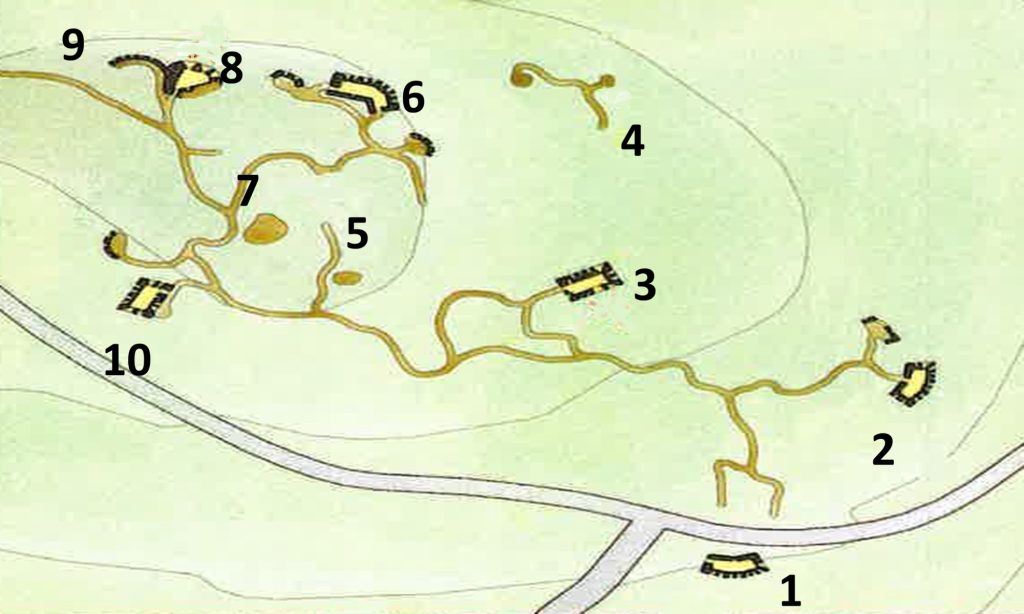
Map with marked points of interest
Types of structures
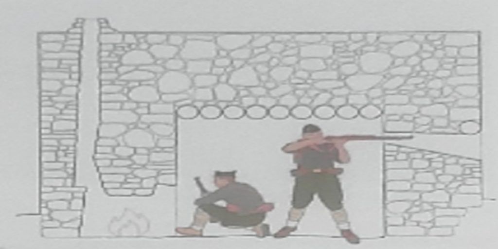
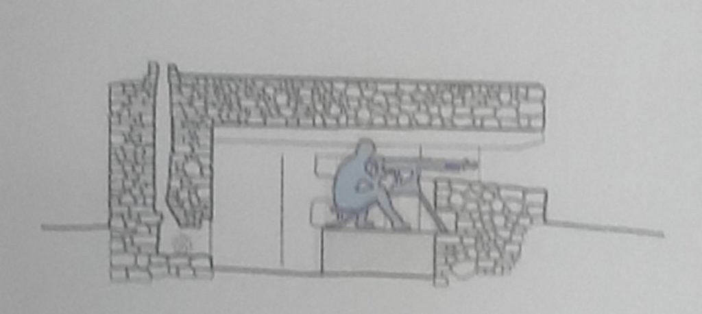
Active shelter for riflemen. Bunquer
Also known as casemates, forts, active shelters or machine-gun nests, although not all of them were designed to accommodate machine guns. In fact, of the six bunkers documented so far at the Vilamur resistance centre, only three were equipped for a machine gun. They can be identified because one of their loopholes is much wider, giving the weapon a broad field of view and fire of up to 180°. The remaining loopholes were intended for rifles and light machine guns.
The bunkers were built from stone bonded with mortar or using timber formwork, with walls one metre thick. Only some loopholes and negative impressions on the concrete walls remain from the formwork. All these structures had reinforced-concrete roofs supported on logs.
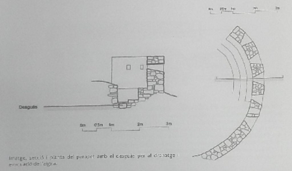
A notable feature of the construction process is the drainage and water-disposal system that can still be seen in some parapets on the tossal, although 80 years after the conflict most of these elements are filled with sediment and are now barely visible.
A final stage in preparing these fortifications was camouflage, intended to keep them hidden from aircraft and to hinder enemy artillery and infantry. These positions were designed to accommodate a squad or platoon of between 8 and 10 soldiers.
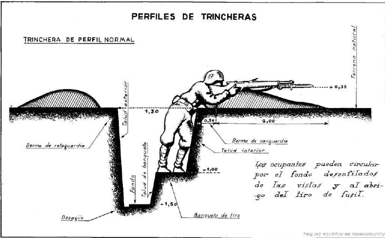
Trenches
The trenches in this defensive complex mainly served as protected communication routes between the various structures and parapets, keeping soldiers out of enemy fire. When necessary, they could also be used as firing positions. Their zigzag layout provided greater protection if a bomb or shell landed nearby, because shrapnel travelled a shorter distance than it would in a straight trench.
They were usually about one and a half metres deep. Sand and stones removed while digging the trench were used to fill sacks placed in front of it, increasing the effective depth to as much as two metres and therefore providing greater protection.
Although some sections of trench can still be traced today, it is clear that during the war there was a much more extensive network of trenches and parapets linking the two fortified hills and the village of Vilamur, which was also fortified. Later earthworks needed to restore the fields for cultivation erased many of these trenches and perhaps other defensive features as well.
Parapets
Built of stone and mortar, the parapets completed the enclosure of the defensive complex and served both observation and defensive purposes, as all of them have loopholes. Archaeological campaigns carried out here in 2008 and 2009 revealed the water drainage and disposal system.
Firing pit
A firing pit is a position projecting from the trench from which one or two soldiers have a good field of view and fire for observation or defence. In this case, the pit was located outside the main complex and appears to have been intended to provide a better view and control of the ravine than was possible from the bunkers and parapets.
Ammunition store
Located in the centre of the position beneath a large rock, a cave-like space was excavated, probably to store ammunition safely.
Pickets and barbed wire
The entire position was surrounded by several rows of wire obstacles, consisting of iron or wooden stakes driven into the ground and connected with barbed wire to form a barrier. Despite their simplicity, these obstacles greatly slowed and hindered any attempt by enemy infantry to occupy the position, leaving attackers exposed to defensive fire. No examples survive at the resistance centre because after the war local residents reused the stakes to mark field boundaries or as grilles for doors and windows.
The name of the site combines tossal, a word of Romance origin that is very common in the Catalan linguistic area, especially in the north-west. It comes from the Latin tossa (or tòs), derived from the pre-Roman Hispanic taucia, referring to a rise in the ground that is neither very high nor particularly steep, and Sant Joan, a hagiotoponym—a place name based on a saint. It comes from the Latin Sanctus Iohannes, referring to local Christian devotion, probably associated with an old chapel, oratory or ritual use of the hill in medieval times.
This etymological explanation has historical support in finds from the latest archaeological campaigns, which uncovered the remains of a medieval necropolis. The discovery confirms that the Tossal de Sant Joan was already a place of settlement and ritual or funerary use in the Middle Ages.
The defensive complex at Sant Joan de Vilamur began to be fortified as soon as Francoist forces reached Pallars in April 1938, although the first documentary record of the position does not appear until 30 July, in the operations diary of the 62nd Division, in connection with a unit rotation.
It was not until August of that year that the centre began to be enlarged and fortified into the form we know today, with concrete forts. Despite the remains that have survived, all evidence suggests that many more features existed during the war.
The main defensive point in the sector was at Les Collades, at more than 2,000 metres above sea level. Republican forces were positioned face to face with it at very close range on the Pla de Caubet.
The red earth beneath our feet originated from the sedimentation of materials during the Permian and Triassic periods, between 299 and 201 million years ago, in a geological environment dominated by plains and numerous rivers. Its colour comes from the presence of iron oxides, particularly haematite.
Geologically, the site lies across the transition between the Pyrenean Axial Zone and the Sub-Pyrenean Zone, within the tectonic structure known as the Nogueres Zone.
The Vilamur sector is a geological reference point for observing the unconformable contact between the Palaeozoic basement—Cambro-Ordovician and Devonian slates and schists affected by the Hercynian orogeny—and the continental Triassic sedimentary cover. The area is dominated by red terrigenous rocks characteristic of the Buntsandstein facies (Lower-Middle Triassic), including red sandstones, mudstones and silica-matrix conglomerates. Near Vilamur and the hill, quartz veins cut through Devonian rocks and contain copper minerals such as chalcopyrite, malachite and azurite. Geomorphologically, the tossal is a residual hill formed by differential erosion of Triassic detrital rocks and slates around local watercourses.
THE SPANISH CIVIL WAR (1936-1939)
Causes of the war
The Second Republic was established to address long-standing problems through an ambitious modernisation programme: secularism, agrarian and social reform, military neutrality and autonomy for regions such as Catalonia.
These reforms met strong opposition from two sides. Established powers—the Church, the military and local elites—saw them as an intolerable threat, while popular sectors considered them insufficient. The contradiction generated major political instability and episodes of violence.
The victory of the left in February 1936 precipitated a military coup on 17 July. Its partial failure, checked by the major cities, workers’ mobilisation and the loyalty of part of the army, divided the country and triggered the Civil War.
The conflict became an ideological and military prelude to the Second World War. While the Francoist forces received decisive and regular support from Fascist Italy and Nazi Germany, the Republic received only irregular aid from the Soviet Union and the International Brigades. This clear military inferiority forced the Republican side onto the defensive and condemned the country to three years of devastating war.
Military development of the conflict
First phase (July 1936 – March 1937): The uprising and the battle for Madrid
The military coup began in Melilla on 17 July 1936. The uprising succeeded in agrarian areas such as Galicia, Navarre and Old Castile, but failed in industrial regions and major cities including Catalonia, Madrid, the Basque Country and Valencia.
Faced with Republican resistance, the rebels’ objective was to take Madrid. Mola’s troops were stopped at Somosierra, while Franco transferred the Army of Africa to the peninsula with German and Italian air support. In August, the rebels took Badajoz and linked the northern and southern armies. On 1 October, Franco assumed absolute military and political command. Madrid nevertheless resisted the direct assault in November (“They shall not pass!”) with the support of the International Brigades. Later attempts to encircle the capital at Jarama and Guadalajara in 1937 failed, forcing the rebels to change strategy.
Second phase (April – November 1937): The northern campaign
Franco redirected the offensive towards the Cantabrian coast to control its industry and mines. With the support of the Condor Legion, large-scale bombing raids were carried out against civilians in cities such as Durango and Gernika. This air superiority and the breaking of the “Iron Ring” led to the fall of Bilbao in June 1937. Santander and Asturias then fell, leaving the whole north in Francoist hands.
Third phase (December 1937 – May 1938): Teruel and the eastern campaign
To relieve pressure on Madrid, the Republic captured Teruel in December 1937. Under extreme cold, however, Franco retook the city in February 1938 and launched a major offensive in Aragon. Lleida fell in April, when Franco abolished Catalonia’s Statute of Autonomy and banned Catalan. On 15 April, Nationalist forces reached the Mediterranean at Vinaròs, splitting Republican territory in two. To halt the advance towards Valencia, the Republic mobilised the “Baby Bottle Draft” and launched offensives along the Segre.
Fourth phase (July 1938 – February 1939): The Battle of the Ebro and the fall of Catalonia
On 25 July 1938, the Republican army crossed the Ebro in an attempt to reconnect its territory and prolong the conflict while awaiting war in Europe. The battle lasted 115 days, with bloody fighting at Pàndols and Cavalls. The Munich Agreement confirmed the Republic’s isolation, forcing a withdrawal back across the river in November. With the defences weakened, Franco captured Barcelona on 26 January 1939 and completed the occupation of Catalonia in February, driving thousands of people into exile.
Fifth phase (February – 1 April 1939): The end of the war
Although the Republic still held the central-eastern zone, Republican morale had collapsed. In March 1939, Colonel Casado rebelled in Madrid against Negrín’s government in an attempt to negotiate peace with Franco. The dictator demanded unconditional surrender. Francoist troops entered Madrid without resistance on 28 March. On 1 April 1939, Franco signed the final war communiqué, ushering in harsh repression and mass exile.
Chronology of the Catalan front (1938-1939)
March 1938: The Francoist army launches a major offensive in Aragon, breaking the defensive line that had been established since the beginning of the war.
4-20 April 1938: Fascist troops advance rapidly through Catalonia, occupying Lleida (4th), Tremp (7th), Sort (12th) and Esterri d’Àneu (15th), before reaching the French border on the 20th.
15 April 1938: Francoist forces reach the coast at Vinaròs, splitting Republican territory and isolating Catalonia from the rest of the Republican zone.
Late April 1938: Franco abandons an immediate conquest of Catalonia and diverts troops towards Valencia. The rebels fortify the front along the Noguera Pallaresa, Segre and Ebro rivers. By controlling the Noguera Pallaresa line, they deprive Catalonia’s war industry of hydroelectric power, forcing it to rely on coal. This allows Republican forces to reorganise.
May 1938: The Republic launches a defensive attack in the Pallars and Noguera areas.
25 July – 15 November 1938: The Battle of the Ebro takes place, the most decisive battle of the conflict in the effort to halt the Fascist advance.
Late December 1938: After nine months of stabilisation along the front, Francoist forces launch the final offensive into Catalonia.
13 February 1939: Franco completes the occupation of all Catalonia.
The war front in Pallars was established according to strategic planning shaped by terrain, communications and resources. The Francoist army deployed a discontinuous series of main and secondary positions at places such as Gerri de la Sal, Vilamur and Llavorsí, while Republican forces were positioned roughly parallel to them to the east.
The Francoists enjoyed a major logistical advantage because of their proximity to the main road and towns, which facilitated troop rotations, supplies and the construction of concrete fortifications. The Republican front line, by contrast, suffered severe isolation and shortages of materials and was largely limited to dry-stone and earthworks.
This asymmetry was evident during the Battle of Baladredo in July 1938. A wounded Francoist soldier could be evacuated to the hospital in Tremp in just over an hour, while a wounded Republican faced a 10-to-12-hour journey along mountain paths to reach La Seu d’Urgell.
As winter approached, the Francoists improved the road network to allow trucks to reach second-line positions. They left only minimum forces on the front line and concentrated most troops in the rear, where they built concrete forts with chimneys to withstand the low temperatures.
When we think of war, the mind immediately evokes bloody fighting and devastation. Although this reality profoundly affected every soldier, most of the time at the front passed in tense calm. Life in the trenches was an altered version of everyday existence, dominated by the constant threat of unpredictable death. Curiously, the soldiers’ most common complaints were not about bombardments but about daily misery: dirt, parasites and poor hygiene. These extreme conditions encouraged the spread of diseases such as typhus and tuberculosis, while also strengthening solidarity among comrades, who shared what little they had and comforted one another in the darkness of night.
Food was a central concern, reflected in diaries and letters from the period. Although hunger hit civilians in the cities hardest, combatants often endured such a poor and inadequate diet that they resorted to improvisation: bartering goods, slaughtering an injured draught animal or simply stealing food. When units were rotated to the rear, access to local markets became the main way to regain strength. Families tried to ease these shortages by sending parcels of clothes and food—vital help, since soldiers lacked sufficient equipment to withstand the climate.
To combat inactivity and the stress of the firing line, commanders—especially in the Republican People’s Army—combined military training and literacy classes for the 30% of soldiers who were illiterate with cultural and sporting activities such as football matches and dances on holidays. Reading and writing also served as essential therapy, offering an escape from the mud and the sound of rifle fire. The real link with life outside the front, however, was correspondence. Receiving a letter not only confirmed that the family was safe and well but reminded the soldier of his identity beyond the conflict; the absence of news, by contrast, plunged troops into deep anxiety.
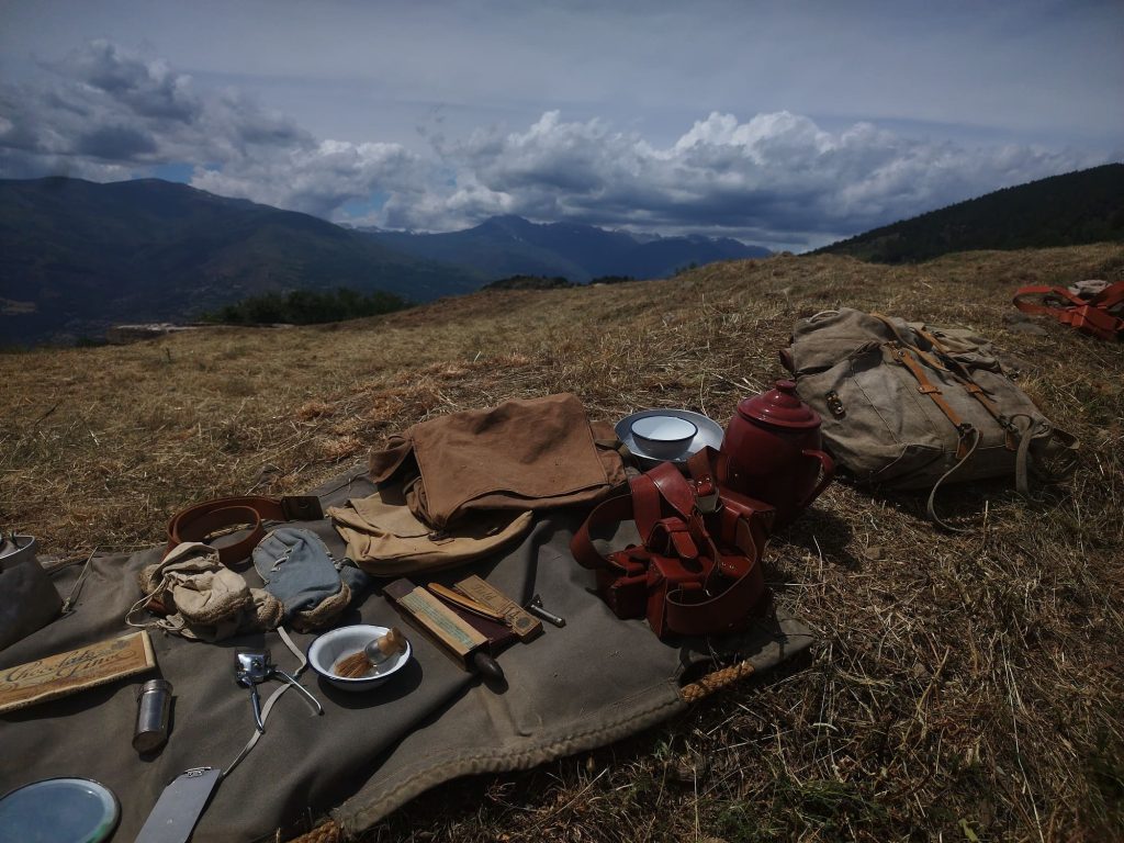
Archaeological work at the Tossal de Sant Joan de Vilamur—occupied by the Francoist 62nd Division between April and December 1938—has recovered numerous military and everyday objects, as well as a medieval discovery.
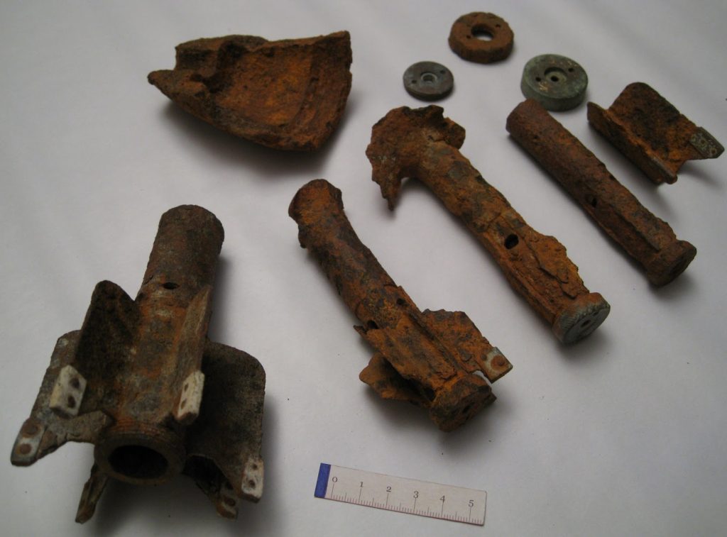
Weapons and military material used on the Pallars Front have been found inside defensive structures such as bunkers, trenches and ammunition stores, including ammunition, fragments of hand grenades, helmet pieces, buckles and ration tins. Cleaning the trenches also revealed everyday objects from the front line in the autumn and winter of 1938, including cooking and eating utensils, glass bottles, medicine vials and remains of footwear and warm clothing.
One of the most significant discoveries was that the trenches and bunkers had been dug over an earlier medieval cemetery or necropolis. During construction of the defences in 1938, the soldiers themselves disturbed and fragmented old graves, while later archaeological excavations recovered human remains and burial pits from the necropolis, showing that the hill had been used as a funerary space long before the Spanish Civil War.
Bibliography / Illustrations / Photographs
TARRÉS CLARET, Pere: El meu diari de guerra. Barcelona: Publicacions de l’Abadia de Montserrat, 2004.
SERRIOL CARRERAS, Amadeu: Diari de guerra (1936-1939). Publicacions de l’Abadia de Montserrat, (2004).
RIART ARNALOT, Oriol: Érem feres: diaris personals de combatents a la Guerra Civil, Lleida, editorial Pagès, setembre de 2023.
RIART ARNALOT, Oriol: El patrimoni bèl·lic de Sant Joan de Vilamur: el front del Pallars 1938-1938, Soriguera Town Council, 2021.
AJUNTAMENT DE SORIGUERA
PASCUAL, H. (ed.): Història de la Catalunya Contemporània, Barcelona: Pòrtic Editorial, 1999.
ARCHIVO GENERAL MILITAR DE ÁVILA